

In the rugged and often unforgiving terrain of mountainous regions, the task of locating individuals in distress has long been a daunting challenge for rescue teams. However, a groundbreaking solution has emerged in the form of Druk GPS, revolutionizing search and rescue operations across the country.
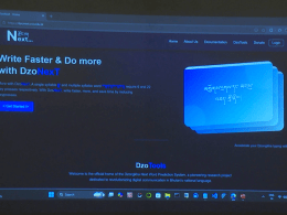
Druk GPS, a cutting-edge Global Positioning System (GPS) technology, offers precise location data and escape routes from any point, providing a lifeline for those in need and significantly enhancing the efficiency of rescue missions. Developed by a team of dedicated volunteers, this innovative technology is freely available to the public, aiming to empower individuals and save lives in critical situations.
The system operates through pre-existing applications and satellite networks, ensuring real-time tracking, emergency alerts, and accurate location information even in areas with limited or no internet connectivity. This offline functionality is particularly vital in remote regions such as mountains or jungles, where traditional communication methods may fail.
Sangay Zangmo, a prominent figure within the Druk GPS initiative, highlighted the significance of this technology in enabling quicker response times during emergencies. With the ability to track routes and share location data, individuals embarking on outdoor activities can now navigate with confidence, knowing that help is readily accessible if needed.
The impact of Druk GPS extends beyond emergency response scenarios. By offering free training sessions, the team equips participants with the necessary skills to harness GPS technology effectively for various purposes, including navigation, communication, and emergency preparedness. Over 1,500 individuals have already benefited from these training programs, underscoring the widespread adoption and positive reception of the initiative.
One of the notable features of Druk GPS is its versatility in application. From tracking buses for passenger safety to facilitating efficient delivery management for businesses, the technology caters to a diverse range of needs across different sectors. Schools can utilize it to coordinate trips more effectively, while families can ensure the safety of their loved ones by sharing locations and messages.
The development journey of Druk GPS was not without its challenges. Over several years, the team dedicated substantial time and effort to refine the technology, overcoming obstacles such as financial constraints and technical limitations. Yet, their perseverance paid off, culminating in a comprehensive GPS solution that sets a new standard for navigation and tracking capabilities.
As the country continues to embrace technological advancements, initiatives like Druk GPS serve as shining examples of innovation driven by a commitment to saving lives and enhancing safety. With its ability to provide precise location data and facilitate swift rescue operations, Druk GPS stands as a beacon of hope for those venturing into the wilderness, offering reassurance that help is never far away.