


In a bid to enhance Bhutan’s capacity in applied remote sensing, NASA recently concluded a four-day training program in the kingdom. The Applied Remote Sensing Training Program (ARSET), held from May 13 to May 16, aimed at bolstering the nation’s capabilities in land use planning, disaster monitoring, and leveraging satellite data effectively.
Led by experts from NASA, the training delved into various aspects of remote sensing, with a particular focus on utilizing Google Earth Engine and advanced machine learning algorithms. Manish Rai, an Associate Analyst at the InnoTech Department of DHI, underscored the significance of these skills, stressing their crucial role in harnessing satellite data for in-country applications.
Participants, including representatives from government agencies and educational institutions, were introduced to methodologies for generating land, water, and disaster-related products from satellite data. The training emphasized the utilization of existing products to assess land use change, manage natural resources, and understand the impacts of climate change.
Funded by the United States Department of State with USD 1.5 million, NASA’s project in Bhutan aims at capacity building in Science, Technology, Engineering, and Mathematics (STEM) fields. A portion of these funds, USD 50,000, was allocated specifically for the ARSET training, highlighting its significance in NASA’s broader initiative.
Tony Kim, the project manager at NASA, elucidated that the training marked a crucial step in their ongoing project, which commenced in October 2019 and is slated to continue until September 2024. Kim reiterated NASA’s commitment to empowering nations like Bhutan with the tools and knowledge necessary for utilizing satellite data effectively.
During the four-day program, participants were equipped with skills to access and analyze data from satellites such as LANDSAT, MODIS, and Sentinel using Google Earth Engine. Sangay Pelzang from GovTech emphasized the advantage of combining Google Earth Engine with programming skills, citing its superiority over standalone software in terms of features and capabilities.
Officials from various agencies, including GovTech Agency, National Land Commission Secretariat, Ministry of Infrastructure and Transport, College of Science and Technology, Ministry of Energy and Natural Resources, and DHI, attended the training. Selection criteria for participation were based on ongoing work and potential for leveraging remote sensing technology in respective fields.
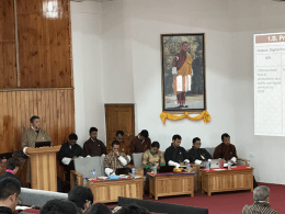
The ARSET training, hosted at the Jigme Namgyel Wangchuck Super Fab Lab, witnessed the participation of over 50 attendees. The enthusiastic engagement of participants underscores the growing recognition of the importance of remote sensing in addressing contemporary challenges and advancing sustainable development goals in Bhutan.
As Bhutan continues to harness the power of technology for socio-economic progress, initiatives like the ARSET training pave the way for building local expertise and fostering innovation in the realm of remote sensing and satellite data utilization. With strengthened capacities and enhanced skill sets, Bhutan is poised to make significant strides in leveraging space-based technologies for the benefit of its people and the environment.